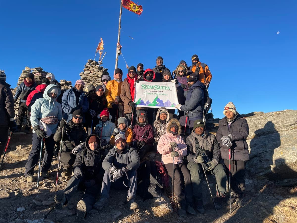

Highlight
Panoramic Himalayan views — Nanda Devi, Dronagiri, Kamet and Chaukhamba
Historic Lord Curzon Trail through the Garhwal Himalayas
Oak & rhododendron forests and beautiful alpine Bugyals
Kuari Pass Trek
The Lord Curzon Trail
Experience the Legendary Lord Curzon Trail in the Garhwal Himalayas — oak and rhododendron forests, alpine Bugyals, traditional villages and panoramic views of Nanda Devi, Dronagiri, Kamet and Chaukhamba.
Experience the Legendary Lord Curzon Trail in the Garhwal Himalayas
The Kuari Pass Trek is one of the most rewarding Himalayan trekking experiences in Uttarakhand. Located in the Chamoli district of the Garhwal Himalayas, this beautiful trail takes trekkers through dense oak and rhododendron forests, traditional Himalayan villages, expansive alpine meadows, dramatic mountain ridges and high-altitude landscapes.
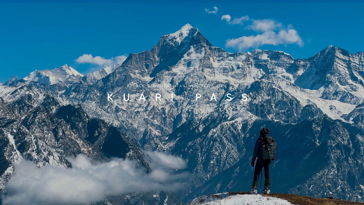
Walk the historic Curzon Trail — snow forests, alpine Bugyals, and Garhwal Himalayan panoramas with IndianTreks.
Popularly known as the Lord Curzon Trail, Kuari Pass has been admired for more than a century for its spectacular Himalayan views. The trail offers an exceptional opportunity to experience the mountains from close range, with panoramic views of some of the most impressive peaks of the Garhwal region, including Nanda Devi, Dronagiri, Kamet, Chaukhamba, Hathi Parvat and Ghori Parbat, depending on weather and visibility.
What makes Kuari Pass particularly special is its balance of adventure and accessibility. The trek offers the feeling of a true high-altitude Himalayan expedition while remaining achievable for trekkers with reasonable fitness and proper preparation. The route combines gradual ascents, forest trails, open Bugyals, mountain ridges and snow-covered landscapes during winter.
Whether you are a first-time trekker looking for your first Himalayan adventure, a family seeking an unforgettable mountain holiday, a student group planning an outdoor experience or an experienced trekker wanting to explore the Garhwal Himalayas, Kuari Pass offers a memorable journey through some of Uttarakhand's most beautiful landscapes.
Walk through ancient Himalayan forests, cross vast alpine meadows and reach the high ridges of Kuari Pass for unforgettable views of the Garhwal Himalayas.
Why is Kuari Pass Trek Famous?
Kuari Pass is famous not only because of its altitude but because of the extraordinary landscape that surrounds the trail.
Why travellers love it
Day wise plan
A complete day-wise plan for Kuari Pass Trek covering drives, trail sections, altitude gain, meals, and overnight stays from start to finish.
Route
Dehradun → Rishikesh → Devprayag → Srinagar → Rudraprayag → Karnaprayag → Nandaprayag → Joshimath
Your Kuari Pass adventure begins with a scenic Himalayan drive towards Joshimath, the gateway and base camp for the trek. Trekkers joining IndianTreks can board from Rishikesh Natraj Chowk in the morning and begin the journey towards the Garhwal Himalayas.
The route follows the beautiful Alaknanda River and passes through several important Himalayan towns and sacred river confluences. With mountain landscapes unfolding along the way, the drive itself becomes an exciting introduction to the trek.
Key Highlights Along the Route
Devprayag: Witness the sacred confluence of the Alaknanda and Bhagirathi rivers, where the Ganga takes its name.
Srinagar (Garhwal): A historic town situated along the Alaknanda River and an important stop on the journey.
Rudraprayag: Located at the confluence of the Alaknanda and Mandakini rivers, surrounded by dramatic Himalayan landscapes.
Karnaprayag: The meeting point of the Alaknanda and Pindar rivers, forming one of Uttarakhand's renowned Panch Prayag.
Nandaprayag: A peaceful Himalayan town where the Alaknanda meets the Nandakini River.
Joshimath: Arrive at the bustling mountain town that serves as the base for several major Himalayan treks.
After reaching Joshimath, check in to the hotel, freshen up and relax after the long mountain drive. The evening can be used to rest and prepare for the upcoming trekking days.
After breakfast, the day begins with a short scenic drive from Joshimath to Tugasi Village, the starting point of your Kuari Pass trek. The approximately 15 km mountain drive takes you deeper into the Himalayan landscape, with traditional villages, forested slopes and panoramic mountain views along the way.
On reaching Tugasi, the trek officially begins. The trail gradually climbs through beautiful Himalayan terrain towards Gulling Campsite, covering around 3 km.
Trek from Tugasi to Gulling
The trail follows a gradual uphill route through forests and open mountain sections. As you gain altitude, the surroundings become increasingly scenic, with expansive views of the valleys and Himalayan peaks.
The relatively short distance makes this a comfortable introduction to the trekking days ahead. However, the gradual altitude gain means trekkers should maintain a steady pace and stay hydrated.
Gulling Campsite
Gulling is a beautiful campsite surrounded by the Himalayan wilderness. On reaching the campsite, settle in and take some time to relax and enjoy the peaceful mountain surroundings.
If weather conditions are favourable, you can enjoy spectacular views from the campsite and experience the changing colours of the mountains around sunset.
The evening will be used for rest, acclimatization and trek briefing before the more demanding sections of the Kuari Pass trail begin.
Overnight stay at Gulling Campsite.
After breakfast, begin your trek from Gulling Campsite towards Khullara, one of the most scenic sections of the Kuari Pass trail. Today’s route takes you gradually higher through dense Himalayan forests before opening into expansive alpine meadows.
Through Himalayan Forests
The trail initially climbs steadily through beautiful forests of Oak, Rhododendron (Buransh) and Horse Chestnut. Depending on the season, the landscape changes dramatically. In spring, blooming rhododendrons add vibrant colour to the trail, while during winter, snow can remain on this forested section for longer periods.
Take your time to enjoy the peaceful surroundings, listen to the forest and maintain a comfortable trekking pace as the altitude increases.
First Himalayan Mountain Views
As the forest gradually becomes thinner, the trail begins to reveal impressive views of the Garhwal Himalayas. Among the prominent peaks visible from this section are:
Dronagiri (7,066 m): A striking pyramid-shaped peak that dominates the surrounding skyline.
Hathi Ghoda Parvat: A distinctive mountain formation known for its elephant-and-horse-like appearance.
This is where the Kuari Pass experience truly starts to open up, with increasingly expansive mountain views replacing the dense forest.
Entering the Alpine Bugyals
Further along the trail, the forest gives way to the spectacular alpine meadows, locally known as Bugyals. The scenery changes from dense green forest to wide-open mountain slopes.
Depending on the season, these meadows may appear lush green, golden-brown or covered in snow. With fewer trees around, you can enjoy sweeping views across the surrounding valleys and Himalayan peaks.
Khullara Campsite
After completing the day’s trek, arrive at Khullara Campsite, a beautiful meadow surrounded by some of the most impressive Himalayan scenery on the route.
From the campsite, you can enjoy views towards the Dronagiri massif, Changabang and Kalanka. The open meadow provides an excellent setting to relax after the day’s trek.
If the weather is clear, the evening can be especially memorable as the setting sun illuminates the snow-covered peaks, creating the famous golden-hour views of the Himalayas.
Khullara is also strategically located for the next stage of the trek, serving as an important camping point before heading towards Kuari Pass and Tali Top.
Overnight stay at Khullara Campsite.
Today is the highlight of your Kuari Pass Trek. After an early breakfast, begin your trek from Khullara Campsite towards the Kuari Pass high point. The trail takes you across open alpine meadows, mountain ridges and rocky sections, with the landscape becoming increasingly dramatic as you gain altitude.
The Ascent to Kuari Pass
The morning trek begins with a steady climb through the high-altitude terrain. Depending on the season and weather conditions, you may encounter snow-covered sections, rocky patches and exposed mountain trails.
As you climb higher, the forest gradually disappears and the trail opens into vast alpine landscapes. The changing perspective reveals magnificent views of the surrounding Garhwal Himalayas, making the climb both challenging and rewarding.
Reaching the Kuari Pass High Point
After several hours of trekking, reach the high point of the trail at approximately 12,516 ft. Take some time to rest, appreciate the incredible Himalayan surroundings and capture photographs.
On a clear day, the panoramic mountain views can include spectacular Himalayan peaks and ranges such as Nanda Devi, Dronagiri, Kamet, Chaukhamba, Hathi Parvat and Ghori Parbat, depending on visibility and the exact viewpoint.
This is the moment to pause and appreciate the scale and beauty of the Himalayas before beginning the descent.
Descent Back to Khullara
After spending time at the high point, begin the descent towards Khullara Campsite, following the mountain trail back through the alpine meadows and ridges.
The descent may feel easier than the ascent, but trekkers should remain careful on loose, rocky or snow-covered sections. Maintain a controlled pace and follow the instructions of the trek leader.
On reaching Khullara, relax at the campsite and enjoy a well-earned evening in the mountains.
Himalayan Views
One of the biggest highlights of today’s trek is the opportunity to witness some of the region’s most impressive Himalayan landscapes. With favourable weather, you may see:
Nanda Devi – One of India’s most iconic Himalayan peaks.
Dronagiri – A striking massif dominating the surrounding landscape.
Kamet – A prominent high-altitude peak of the Garhwal Himalayas.
Chaukhamba – A spectacular group of Himalayan peaks.
Hathi Parvat – A distinctive mountain visible from sections of the trail.
Ghori Parbat – Another prominent peak forming part of the surrounding Himalayan panorama.
Please note: Mountain visibility depends heavily on weather, cloud cover and seasonal conditions.
After completing the day’s trek, return to Khullara Campsite for dinner and overnight rest.
Overnight stay at Khullara Campsite.
After breakfast, begin your final trekking day with a gradual descent from Khullara Campsite towards Tugasi Village, the roadhead where the trek concludes.
Descent from Khullara to Tugasi
The trail gradually loses altitude as you make your way back through the Himalayan landscape. The route passes through forested sections, mountain slopes and village trails, offering a different perspective of the terrain you experienced during the ascent.
Although today’s route is mostly downhill, the distance is considerable. Maintain a comfortable pace and take regular short breaks, especially while navigating uneven or rocky sections.
After approximately 8.5 km and 6–7 hours of trekking, you will reach Tugasi Village Roadhead, marking the completion of your Kuari Pass trekking experience.
Drive from Tugasi to Joshimath
Once you reach Tugasi, our Indian Treks transport team will be ready to transfer you back to Joshimath.
The approximately 15 km drive takes around 30 minutes to 1 hour, depending on road and weather conditions. Enjoy the final views of the surrounding mountains and valleys as you descend towards Joshimath.
On arrival, check in to your hotel and take some well-deserved time to rest, freshen up and relax after completing the trek.
The evening is free to explore the local market of Joshimath, purchase souvenirs or simply unwind with your fellow trekkers and share memories from the trail.
Overnight stay at Joshimath Hotel.
Route
Joshimath → Nandaprayag → Karnaprayag → Rudraprayag → Srinagar → Devprayag → Rishikesh → Dehradun
After breakfast, it is time to begin your journey back from Joshimath to Rishikesh and Dehradun, marking the end of your Kuari Pass adventure.
Start early in the morning, around 6:00 AM, for the long scenic drive through the Garhwal Himalayas. The route follows the Alaknanda River and takes you through several picturesque mountain towns and valleys that you may have passed during your onward journey.
Scenic Himalayan Drive
As you descend towards the lower Himalayan region, enjoy changing landscapes, winding mountain roads, river valleys and beautiful views of the surrounding mountains.
The journey passes through important towns and landmarks including
Nandaprayag – The confluence of the Alaknanda and Nandakini rivers.
Karnaprayag – Located at the confluence of the Alaknanda and Pindar rivers.
Rudraprayag – Where the Alaknanda and Mandakini rivers meet.
Srinagar (Garhwal) – A major town situated along the Alaknanda River.
Devprayag – The sacred confluence of the Alaknanda and Bhagirathi rivers.
Rishikesh – The gateway to the Garhwal Himalayas and the final major stop of the journey.
A lunch break and short refreshment stops will be taken en route, depending on the group’s travel schedule and road conditions.
Journey Completion
After approximately 9–10 hours of driving, reach Rishikesh Natraj Chowk, where the Kuari Pass trek journey officially concludes for trekkers opting for the Rishikesh drop.
For trekkers continuing to Dehradun, the vehicle will proceed onwards after the Rishikesh drop.
Take home not just photographs, but the memories of alpine meadows, Himalayan forests, high mountain trails and breathtaking Garhwal landscapes experienced along the Kuari Pass trail.
Trek ends with beautiful memories of the Himalayas.
Itinerary route map
6-day Kuari Pass (Curzon Trail) — Day 1 Dehradun/Rishikesh Natraj Chowk → Joshimath via Devprayag, Srinagar, Rudraprayag, Karnaprayag & Nandaprayag; Day 2 Joshimath → Tugasi → Gulling Campsite; Day 3 Gulling → Khullara Campsite; Day 4 Khullara → Kuari Pass → return Khullara; Day 5 Khullara → Tugasi → Joshimath; Day 6 Joshimath → Rishikesh → Dehradun.
Text route list (accessible alternative to the map)
Elevation profile
Distance-based altitude chart for Kuari Pass Trek using verified trek segment distances. Hover or drag across the profile to explore each stage.
| Day | Location | Altitude | Distance | Duration | Δ from prev. |
|---|---|---|---|---|---|
| Day 1 | Joshimath | | 2,089 ft → 7,545 ft | Approx. 280 km drive | 9–10 hrs | — |
| Day 2 | Tugasi Village | 7,545 ft → 8,530 ft → 9,264 ft | Approx. 3 km trek | 3–4 hrs | +1,719 ft |
| Day 3 | Khullara Campsite | 9,264 ft → 11,014 ft | Approx. 5.5 km trek | 8–9 hrs | +1,750 ft |
| Day 4 | Kuari Pass | 11,014 ft → 12,516 ft → 11,014 ft | Approx. 8 km trek | 8–9 hrs | +1,502 ft |
| Day 5 | Tugasi Village | 11,014 ft → 8,530 ft → 7,545 ft | Approx. 8.5 km trek | 6–7 hrs | -1,502 ft |
| Day 6 | Rishikesh/Dehradun | | 7,545 ft → 2,089 ft | Approx. 280 km drive | 9–10 hrs | -3,469 ft |


Inclusion & exclusion
A detailed overview of everything included in your Kuari Pass Trek package — stays, meals, permits, transport, and trek support — along with the costs you should plan for separately.
Inclusions
Exclusions
- Bag offloading is charged at ₹1,600 per bag.
- Maximum weight per offloaded bag should not exceed 10 kg.
- All package prices are quoted before 5% GST.
Kuari Pass Trek Safety & Emergency Evacuation
Safety Is an Essential Part of Every IndianTreks Journey. The Kuari Pass Trek takes you deep into the Himalayas, where altitude, weather and terrain can change quickly. Reaching an altitude of approximately 12,500 ft, the trek requires proper preparation, responsible trekking practices and a clear understanding of high-altitude safety.
At IndianTreks, we consider safety to be an integral part of the trekking experience — not something that begins only when an emergency occurs. Our trek leaders and ground teams monitor the group, weather, trail conditions and individual well-being throughout the journey and make operational decisions with safety as the first priority.
At the same time, every trekker has an important role to play. Being physically prepared, carrying the recommended equipment, following the trek leader’s instructions and reporting health concerns honestly are essential to maintaining a safe trekking environment.
High-Altitude Safety on the Kuari Pass Trek
As altitude increases, atmospheric pressure decreases and the body receives less available oxygen. The human body requires time to adapt to these conditions.
The Kuari Pass itinerary follows a gradual progression in altitude, allowing trekkers to adjust before reaching the higher sections of the route. However, altitude-related problems can affect anyone, including experienced trekkers and physically fit individuals.
For this reason, every trekker should understand the symptoms of Acute Mountain Sickness (AMS) and know when to stop, inform the trek leader and descend.
Acute Mountain Sickness (AMS)
Recognising the Early Symptoms
AMS is one of the most common altitude-related concerns during Himalayan trekking. Early symptoms can include:
- Headache
- Nausea
- Loss of appetite
- Dizziness
- Unusual tiredness
- Weakness
- Difficulty sleeping
- General feeling of being unwell
These symptoms should not simply be ignored or hidden from the trekking team. If you feel unusually unwell at altitude, inform your trek leader immediately. Early reporting allows the team to assess your condition and decide whether you should rest, descend or receive medical attention.
Serious Altitude-Related Warning Signs
In rare cases, altitude illness can become serious and potentially life-threatening.
Warning Signs That Require Immediate Attention
Possible HACE Symptoms
High Altitude Cerebral Edema may involve:
- Severe or worsening headache
- Confusion or unusual behaviour
- Difficulty maintaining balance
- Difficulty walking normally
- Extreme weakness
- Reduced alertness or consciousness
Possible HAPE Symptoms
High Altitude Pulmonary Edema may involve:
- Breathlessness beyond what is expected from physical exertion
- Difficulty breathing while resting
- Persistent or worsening cough
- Chest tightness
- Severe weakness
- Unusual respiratory distress
Do not continue ascending when serious altitude-related symptoms are present. The trek leader’s decision regarding rest, descent or evacuation must be followed immediately.
How IndianTreks Manages Altitude Risk
1. Gradual Ascent
The Kuari Pass itinerary is designed to progressively increase altitude rather than taking trekkers directly to the highest point. The route generally progresses through:
Joshimath → Gulling → Khullara → Kuari Pass
This progressive approach supports acclimatization and gives the trek team opportunities to monitor how trekkers are adapting. Skipping planned stages or attempting to gain altitude faster than the itinerary is not recommended.
2. Comfortable Pace
High-altitude trekking is about endurance, not speed. Our trek leaders encourage a slow, steady and sustainable pace. Trekkers should:
- Avoid unnecessary rushing
- Maintain a comfortable walking rhythm
- Take controlled breaks
- Conserve energy for longer sections
- Stay within the designated group
- Follow the guide’s instructions regarding pace
The objective is not to reach first. The objective is to reach safely.
Hydration & Nutrition
Proper hydration and nutrition are important during a high-altitude trek. Trekkers should:
- Drink water regularly throughout the day
- Carry adequate water capacity
- Eat meals and snacks at regular intervals
- Carry personal energy snacks when required
- Use ORS/electrolytes when appropriate
- Avoid excessive alcohol consumption during the trek
There is no single water quantity that is appropriate for every trekker. Hydration requirements vary depending on weather, exertion, individual needs and medical conditions. Do not force excessive amounts of water. Drink regularly and listen to your body.
Medication & Medical Preparation
Before undertaking a high-altitude trek, trekkers should consult a qualified medical professional if they have concerns regarding altitude exposure, existing medical conditions or medication requirements.
Medication such as acetazolamide (Diamox) should only be taken after appropriate medical consultation and according to professional medical advice.
Trekkers should carry:
- Personal prescription medicines
- Basic first-aid supplies
- Doctor-recommended medication
- Relevant medical information
- Emergency contact details
Please inform the IndianTreks trek leader about any important medical requirements before beginning the trek.
Weather & Trail Safety
Himalayan weather can change rapidly, particularly at higher elevations. Depending on the season, trekkers may encounter:
- Rain
- Snow
- Strong winds
- Fog
- Low temperatures
- Slippery trails
- Reduced visibility
Our team continuously assesses conditions and may adjust the trekking schedule, route or turnaround point when necessary.
The Summit Is Optional. Safety Is Not.
If weather, snow, trail conditions or a trekker’s health make further progress unsafe, the trek leader may recommend stopping or descending. Such decisions are made to protect the entire group.
Winter & Snow Safety
During winter departures, snow can cover sections of the Kuari Pass trail. Depending on actual conditions, trekkers may require:
- Proper winter trekking shoes
- Gaiters
- Trekking poles
- Warm waterproof gloves
- Insulated clothing
- Appropriate traction equipment when advised
Snow conditions can change from one season to another. The final equipment requirement will therefore depend on the actual trail conditions at the time of the trek. Trekkers should never attempt unfamiliar snow-covered sections independently.
Group Safety & Trek Discipline
Maintaining group integrity is an important part of Himalayan trekking. Every trekker must:
- Stay with the designated group
- Follow the trek leader and guide
- Never take unauthorized shortcuts
- Never trek alone
- Inform the team before stopping
- Follow instructions regarding difficult terrain
- Avoid unnecessary risks for photographs
- Stay away from exposed edges and unstable slopes
- Never leave the trail or group without informing the trek leader
Emergency Response Protocol
If a trekker becomes seriously ill or injured, the response generally follows four priorities:
1. Assess
The trek leader and support team assess the trekker’s condition and the surrounding environment.
2. Stabilize
Immediate first-aid and other appropriate support are provided according to the situation and available resources.
3. Descend
When altitude illness is suspected, descent to a lower elevation may become the most important intervention.
4. Evacuate
If required, the trekker is moved towards an accessible roadhead and appropriate medical assistance is arranged.
The exact response depends on the location, severity of the emergency, weather, trail conditions and available local resources.
Emergency Evacuation from Kuari Pass
The most important principle during a serious high-altitude emergency is: Descend to a Lower Altitude.
An evacuation route cannot always be predetermined because Himalayan conditions can change rapidly. Depending on the location of the incident, evacuation may involve:
High-Altitude Trail → Lower Campsite → Village/Roadhead → Vehicle → Medical Facility
In difficult terrain, local support personnel may assist with moving an injured or unwell trekker using appropriate evacuation equipment. The trek leader will determine the safest practical evacuation direction based on the circumstances.
Emergency Exit Strategy
The appropriate emergency exit depends on the trekker’s location.
Lower Trail & Forest Sections
If an emergency occurs during the lower sections of the trek, the priority is generally to retreat towards the nearest accessible village or roadhead.
Gulling & Intermediate Sections
For emergencies around the Gulling and surrounding forest sections, the team will assess the safest route back towards the lower trail and available road access.
Khullara & Higher Sections
If a serious medical problem occurs around Khullara or the higher-altitude sections, the priority is to descend rather than continue towards Kuari Pass. The evacuation route will be selected according to current trail, weather and snow conditions.
Kuari Pass / High Ridge
If an emergency occurs near the pass or high ridge, the affected trekker will be moved towards a safer and lower section of the trail as quickly as practical. The safest emergency route is determined by the trek leader based on real-time conditions.
Medical Assistance & Evacuation
Once a trekker reaches an accessible roadhead, transportation to an appropriate medical facility can be arranged based on the severity of the situation. Depending on the medical assessment, the trekker may require:
- First-level medical treatment
- Oxygen support where medically appropriate
- Further observation
- Referral to a larger medical facility
- Advanced treatment in a tertiary-care hospital
The destination will depend on the nature and severity of the emergency and the medical resources available at that time.
Helicopter Evacuation
In a critical emergency, aerial evacuation may be considered when ground evacuation is not practical or sufficiently fast. However, helicopter evacuation is not guaranteed and depends on several factors, including:
- Weather conditions
- Visibility
- Wind speed
- Landing-site accessibility
- Aircraft availability
- Local administration
- Rescue coordination
- Medical urgency
- Operational permissions
Never assume that a helicopter will be immediately available in a Himalayan emergency. For this reason, trekkers should always consider appropriate travel insurance with trekking and emergency evacuation coverage.
Communication During the Trek
Mobile connectivity can be limited or unavailable in remote Himalayan areas. Trekkers should therefore not depend exclusively on their personal mobile phones during the trek. We recommend:
- Keeping your phone fully charged
- Carrying a power bank
- Saving important numbers before departure
- Sharing your itinerary with a family member or trusted contact
- Following the communication procedures established by the trek team
Emergency communication arrangements may vary depending on the location and prevailing network conditions.
Your Responsibility as a Trekker
Safety is a partnership between the trekking operator, trek leaders and every individual participant.
Report Health Problems Immediately
Inform your trek leader if you experience:
- Headache
- Nausea
- Dizziness
- Unusual fatigue
- Breathing difficulty
- Chest discomfort
- Difficulty walking
- Confusion
- Any sudden or unusual change in your health
Never hide symptoms to avoid slowing down the group. A responsible decision to stop or descend can prevent a minor problem from becoming a serious emergency.
Carry the Recommended Equipment
Every participant should arrive properly equipped for the trek. Essential items include:
- Good-quality trekking shoes
- Warm clothing layers
- Waterproof jacket
- Trekking pants
- Gloves
- Woollen cap
- Sunglasses
- Sunscreen
- Trekking poles
- Headlamp
- Personal medicines
- Basic first-aid supplies
- Adequate water bottles
- Backpack rain cover
Additional winter equipment may be required depending on seasonal snow and trail conditions.
Responsible Trekking Practices
Safety also means respecting the mountains and local communities. Please:
- Stay on designated trails
- Follow your trek leader’s instructions
- Do not take unnecessary risks
- Do not disturb wildlife
- Respect local communities and traditions
- Do not damage vegetation
- Keep natural water sources clean
- Avoid unnecessary noise
- Carry your waste back
- Follow campsite and waste-management instructions
Leave No Trace
The Himalayan environment is fragile and deserves our respect. Every IndianTreks traveller is expected to follow responsible trekking practices.
Carry It In. Carry It Out.
Never leave:
- Plastic wrappers
- Bottles
- Batteries
- Tissues
- Food packaging
- Other non-biodegradable waste
Do not bury or burn plastic or other harmful waste. Use designated sanitation facilities wherever available and follow the instructions of your trek team. Protect the mountains that give us the adventure.
Pre-Trek Safety Checklist
Before starting your Kuari Pass Trek, make sure you have:
- Prepared physically for the trek
- Consulted your doctor if required
- Packed appropriate seasonal clothing
- Broken in your trekking shoes
- Carried personal medication
- Packed a headlamp and power bank
- Carried adequate water capacity
- Packed basic first-aid supplies
- Protected important documents
- Shared your itinerary with family/friends
- Checked your travel insurance coverage
- Understood the trek leader’s safety instructions
Important Emergency Information
In case of an emergency, the IndianTreks team will coordinate with available local resources and authorities according to the nature and location of the incident.
Emergency response may involve local guides, support staff, road transportation, medical facilities and government rescue agencies where required.
Because emergency numbers, local facilities and rescue arrangements can change, trekkers should use the latest emergency contact information provided by IndianTreks before departure.
Our Safety Promise
At IndianTreks, we believe that a successful trek is not simply about reaching the highest point. A successful trek means exploring responsibly, respecting the mountains, supporting your fellow trekkers, making safe decisions, and returning home with unforgettable memories.
No trekking operator can eliminate every natural risk associated with high-altitude environments. Mountain weather, terrain and individual health conditions remain unpredictable.
What we can do is prepare responsibly, maintain experienced ground support, follow established safety practices and make informed decisions when conditions change.
Your Safety. Our Responsibility. The Himalayas, Our Respect.
IndianTreks — Explore Responsibly. Trek Safely. Return with Memories.
Delicious & Nutritious Food During Trek
Fresh, high-altitude meals designed for energy and warmth on Kuari Pass Trek — breakfast, lunch, evening snacks, and dinner prepared by experienced cooks.
Breakfast
- Beverages: ginger/masala tea, coffee, juice
- Indian: paratha, poha, porridge, omelettes, upma
- Light options: sandwiches, jam and butter
Lunch & dinner
- Fresh roti, seasonal vegetable sabzi, dal, rice, and paneer dishes
- Hot soup and snacks on arrival at camp
- Vegetarian meals standard; inform us of dietary restrictions at booking
Trail snacks
- Energy bars, dry fruits, and packed lunch on long walking days
- Electrolyte sachets recommended — carry your preferred brand
- Plenty of safe drinking water at camps; refill bottles each morning
Best Time to Visit Kuari Pass Trek
Kuari Pass Trek runs best during December - April. Timing changes the trail conditions, the views, and how busy the route feels, so here is what to expect across the year.
December - April: Peak Season
This is the window Kuari Pass Trek is built around. Trails are at their best, campsites are fully operational, and departures run every month with the largest choice of dates.
- Daytime temperature: 6°C – 12°C
- Night temperature: -5°C – 4°C
- Snow: consistent snow cover on the upper trail
- Crowds: high on weekends, quieter on weekday batches
Shoulder Season: Fewer Crowds
Just before and after the December - April window the route stays open but the groups are smaller. Conditions are slightly less predictable, and the reward is a much quieter trail.
- Daytime temperature: 10°C – 18°C
- Night temperature: 2°C – 8°C
- Rainfall: light and infrequent
- Crowds: low to moderate
Off Season: Limited Access
Outside the main window the higher sections can be blocked by snow, monsoon damage, or forest department closures. Departures are paused and we recommend planning inside the December - April window instead.
- Trail access: partial or closed on the upper route
- Views: can be excellent on clear days
- Support: limited stays and transport near the base
- Crowds: very low
Kuari Pass Trek Packing List — Essential Gear, Clothing & Safety Checklist
A successful Kuari Pass Trek begins with the right preparation. The Himalayan weather can change quickly, and conditions may vary from sunny trails to strong winds, rain, cold temperatures and snow, especially during winter.
At IndianTreks, we recommend following a “Pack Smart, Pack Light, Pack for Safety” approach. You do not need to carry unnecessary equipment, but a few essential items are extremely important for comfort, warmth, hydration and safety.
This Kuari Pass Trek packing list has been prepared to help you understand what to carry, why you need it and how to pack it efficiently.
Our Packing Philosophy: Essential Over Excess
When packing for a Himalayan trek, carrying more does not always mean being better prepared. A heavy backpack can make steep ascents and descents considerably more tiring.
Your priority should be:


How to Reach Kuari Pass Trek Base Camp
Planning your journey properly is an important part of a successful Kuari Pass Trek. Your adventure begins with reaching the designated pickup point in Rishikesh, from where the IndianTreks team continues the journey towards Joshimath, the base location for the trek.
Whether you are travelling from Delhi, Mumbai, Bengaluru, Jaipur, Kolkata or another part of India, you can reach Rishikesh by flight, train, bus or road. We recommend planning your arrival and return journey with sufficient buffer time so that unexpected traffic, weather conditions or transport delays do not affect your trek.
Modes of Transport to Reach Rishikesh
Rishikesh is one of the major gateways to the Garhwal Himalayas and serves as the primary pickup city for the Kuari Pass Trek.
Fast and convenient — fly into Dehradun (Jolly Grant Airport), then continue to Rishikesh by road.
Comfortable and dependable — arrive at Rishikesh Railway Station, or via Haridwar with a short road transfer.
Economical and convenient — overnight and daytime buses connect Rishikesh with Delhi and other major cities.
Flexible for private travellers — drive or hire a cab from Delhi, Haridwar, Dehradun, Chandigarh and nearby cities.
Since transportation schedules can change, always check the latest timings before booking your tickets.
1. By Flight — Fastest Option
Jolly Grant Airport (Dehradun Airport) is located approximately 20–25 km from Rishikesh, depending on the destination point. The airport has air connectivity with major Indian cities, including Delhi and other metropolitan cities, although flight schedules and direct connections vary by date and season.
From the airport, you can reach Rishikesh by private taxi, app-based cab where available, airport taxi services, or a pre-booked transfer.
If you are travelling by flight, we recommend reaching Rishikesh one day before the trek departure whenever possible. This gives you sufficient time in case of flight delays, traffic or other unforeseen circumstances.
Travellers arriving early can stay near the Rishikesh pickup area and report at the designated pickup point the following morning.
Avoid booking a flight that arrives immediately before the trek departure time.
2. By Train — Comfortable & Dependable
Rishikesh Railway Station is convenient for travellers arriving by train. Depending on your origin, you may also find more frequent train connections to Haridwar, from where Rishikesh can be reached by road.
Train services are available from Delhi and other major cities, with overnight options often being convenient for trekkers.
Book your ticket well in advance during peak trekking seasons.
AC or sleeper accommodation is recommended for overnight journeys. Keep sufficient time between your train arrival and trek pickup.
If your train reaches late at night or early in the morning, plan your accommodation accordingly. Always verify the latest railway schedule before booking.
For a stress-free trek experience, reaching Rishikesh one day before departure is the safest option, particularly if you are travelling from another state.
3. By Bus — Affordable & Convenient
Rishikesh is well connected by road with Delhi, Haridwar, Dehradun, Chandigarh, Jaipur and several other cities.
Travellers from Delhi can choose Volvo buses, AC sleeper buses, AC seater buses, non-AC buses, private intercity buses and state transport buses.
Overnight buses are particularly convenient because they can allow you to reach Rishikesh early in the morning.
If you are travelling by overnight bus, choose a service that reaches Rishikesh before the scheduled trek pickup time, while still allowing some buffer for delays.
Do not book your onward trek transportation based on an exact bus arrival time, as road traffic can affect the actual arrival.
4. By Road — Flexible for Private Travellers
Private travellers can drive or hire a dedicated cab to Rishikesh from Delhi, Haridwar, Dehradun, Chandigarh and other nearby cities. This option offers the most flexibility on arrival timing.
Allow extra time for mountain traffic, weekend rush and weather-related slowdowns. Aim to reach Rishikesh the evening before trek departure whenever possible.
Rishikesh to Joshimath — Your Journey to the Trek Base
Rishikesh to Joshimath is approximately 250–270 km.
Approximately 9–11 hours, depending on road and traffic conditions.
Rishikesh → Devprayag → Srinagar → Rudraprayag → Karnaprayag → Nandprayag → Chamoli → Joshimath.
Along the way, you will travel beside the Alaknanda River and pass through several important mountain towns and river valleys. The journey itself is an important part of the Kuari Pass experience, with changing landscapes from the foothills to the higher Garhwal Himalayas.
IndianTreks Transportation from Rishikesh to Joshimath
If you have selected the IndianTreks transportation option, our team will coordinate the journey from the designated pickup point in Rishikesh to Joshimath.
Depending on the group size and operational requirements, transportation may include Tempo Traveller, Traveller vehicle, SUV, Innova-type vehicle or other suitable group transportation. Vehicle allocation may vary depending on the number of trekkers in the batch.
Rishikesh
Natraj Chowk, Rishikesh
As communicated by IndianTreks before departure. Pickup time may vary depending on the departure batch — always follow the latest pickup instructions shared by the IndianTreks operations team.
Joshimath
Approximately 9–11 hours
We recommend reaching the pickup point 10–15 minutes before the reporting time so that the group can depart on schedule.
Other Options to Reach Joshimath
Local and state-run buses operate towards Joshimath, but mountain-bus schedules can be limited and may change according to season, road conditions and operational factors. If you are planning to use public transport, check the latest departure schedule locally and keep sufficient buffer time.
Shared taxis may be available from Rishikesh or other major points towards the Garhwal region. Availability and departure timings can vary, particularly during the early morning hours.
A private cab is another convenient option for travellers who prefer flexibility and direct travel. Private taxis are especially useful for families, small private groups, travellers arriving outside the scheduled pickup window, and trekkers who prefer a dedicated vehicle.
Planning Your Return Journey from Joshimath to Rishikesh
After completing your Kuari Pass Trek, we recommend keeping your return travel flexible.
Approximately 6:30–7:30 AM
Approximately 7:30–8:30 AM
Around 8:00–9:00 AM
Approximately 9–11 hours
Around 5:00–7:00 PM
These timings are indicative and may change according to the actual trek schedule, weather, road conditions, traffic and group movement.
We strongly recommend booking your flight, train or long-distance bus from Rishikesh after 8:00 PM, preferably with additional buffer time. For important onward journeys, consider keeping 2–3 hours of extra buffer rather than planning a tight connection.
Policy
Booking, cancellation, refund, and participation terms so you know exactly where you stand before joining Kuari Pass Trek.
| Policy Point | Details |
|---|---|
| Pickup Time | Around 6:30 AM from Rishikesh (Tapovan–Badrinath Road & Railway Station area) |
| Drop Time | Evening arrival (~6–7 PM) in Rishikesh / Dehradun |
| Pickup & Drop | Dehradun / Rishikesh ↔ Joshimath — Tempo Traveller (Non AC) |
| Food | All vegetarian meals during the trek provided by Indian Treks |
| Booking Confirmation | Seat confirmed after advance payment is received |
| Balance Payment | Remaining amount before departure as instructed by the team |
| ID Requirement | Valid government photo ID mandatory for forest permits |
| Operational Changes | Itinerary may adjust for weather, road, or safety reasons |
Departures and route decisions remain subject to weather, road access, local administration, and safety conditions. Final operational calls are always taken in the interest of the group.
FAQ's
Common questions about Kuari Pass Trek — difficulty, altitude, fitness, permits, stays, and what to expect on the trail.
Trekking in Kuari Pass is most enjoyable between March to mid-June and September to November. These windows offer pleasant weather and natural beauty — greenery and seasonal waterfalls. Winters can be quite cold, so many hikers prefer the shoulder seasons for comfort.
From December through April, the Kuari Pass area is typically blanketed in heavy winter snow. Cold weather can make some sections more challenging. In April you may still find snow at the campsites, or only at the pass — conditions vary year to year with snowfall.
Yes. Kuari Pass is in the Garhwal Himalayas and is an excellent way to experience the mountains. First-time hikers need not hold back — the difficulty is beginner to intermediate (easy to moderate). The scenery and fresh air make the summit experience especially rewarding.
Kuari Pass is in Nanda Devi National Park, Chamoli District, Uttarakhand, India.
The Kuari Pass trek distance is about 37 kilometres. The journey is moderately demanding and traditionally begins from the Auli / Joshimath side of the trail.
Previous hiking experience is helpful but not required. If you have trekked before, it is a bonus. We recommend starting a fitness routine about a week before the hike that includes aerobic and running workouts (ideally build this over 4–6 weeks for best results).
March through June and September through December are ideal for hiking the Kuari Pass trail. Winter is especially popular for the nicest snow views and quieter trails.
Yes — Kuari Pass offers a reasonable degree of safety. It is graded easy–moderate, so the path does not carry extreme technical risk. Stay alert, follow your trek leader, and take standard mountain safety precautions to avoid problems.
Rishikesh is the starting point for Indian Treks’ Kuari Pass journey. Reach Rishikesh by taxi, bus, train, plane, or private vehicle, then continue to Joshimath / Auli. The trek gets underway from this region. Trek distance is about 37 km; Kuari Pass height is 3,814 m (12,516 ft). See the How to Reach section for gateway details.
ATMs are available in Joshimath. Withdraw enough cash before you leave Rishikesh or your base city — there are no ATMs on the trail itself.
Lodges at Tapovan / Auli typically have concrete bathrooms. On camping days, bio-toilets (toilet tents) are set up around each campsite. Contact Indian Treks for package-specific toilet arrangements.
You get a strong network signal through to Joshimath. On day one you may also get 4G around Auli. On the trail, especially the first and last walking days, signal can drop. In favourable weather, Jio and BSNL may work at base camp — do not rely on continuous coverage.
Rishikesh is the largest nearby city. From there the road trip continues to Joshimath (or Auli). Travel by road from Rishikesh to Joshimath / Auli usually takes about 8–12 hours, depending on road condition, landslides, weather, and traffic.
Why Kuari Pass Trek with Indian Treks
Trusted Himalayan operator for treks across Uttarakhand, Himachal, Nepal, and Kashmir — safety-first teams, transparent pricing, and trekkers who return season after season.
Panoramic Himalayan views — Nanda Devi, Dronagiri, Kamet and Chaukhamba
Historic Lord Curzon Trail through the Garhwal Himalayas
Oak & rhododendron forests and beautiful alpine Bugyals
Winter snow experience on forests, meadows and ridges
What you can expect


Rental gear for this trek


Rentals are collected at the base camp and returned at the end of the trek. Pick a size to reserve kit for this departure.